SOYLsight drone technology at Lamma 2014
The latest UAV (unmanned aerial vehicle) technology will be demonstrated for the first time at this year’s LAMMA show.
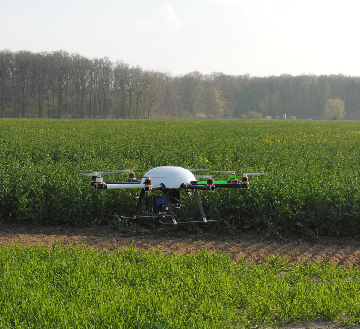
The new device will be displayed by precision crop production specialist SOYL to show growers how it can be used to identify crop performance issues, even before they become apparent to the naked eye.
SOYL’s commercial director, Simon Parrington, explains, “Three years ago we began trials with a range of drone systems and this has accelerated over the last 12 months as the technology has matured. We’re really looking forward to sharing these developments with growers, including at LAMMA later this month.”
As a multi rotor platform, the SOYLsight copter offers unrivalled performance, with the ability to fly autonomously following programming and flexible payload options. Flying at almost 20mph and at an altitude of 100 metres, the UAV’s primary task is to take images of crops; using a multi spectrum camera, this can highlight areas of plant stress before they become evident to the grower.
The benefits are not limited to monitoring crop health. The UAV’s sensors can also identify areas of weed in crops. Increasing seed rates has become common in order to suppress blackgrass and the accurate weed maps produced by the UAV will be useful in this important cultural control.
“The launch of SOYLsight represents another significant investment in our precision crop production platform, enabling us to share innovative methods and new data with growers to help increase farming efficiency” explains Simon. “SOYLsight also complements our MySOYL platform which pulls together a wide range of data sources into one easy to use portal.”
SOYLsight will consist of three core service areas:
Standard aerial photography: ideal for real estate photography and mapping of non-cropped areas.
3D photography: for landscape photography, such as golf courses.
High resolution imagery: used for crop scouting, weed mapping, yield estimates and plant counting.
The images taken are made up of individual pixels of just 20cm and the SOYLsight copter flight path is automatically calculated from the field boundary. The images collected are then available to download from MySOYL to assess crop conditions and take any necessary action.
To find out more about SOYLsight, visit SOYL on stand 760, hall 7 at Lamma 2014 or call 01635 204190.