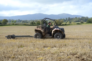
 Electrical conductivity soil scanning is a survey that takes hundreds of soil readings per hectare to identify where variation exists in a field. This map can be used to target cultivations, seed rates, soil sampling regimes and many other precision activities.
The sensor travels the whole field taking readings of shallow and deep conductivity, and logging the position of each reading.
The conductivity readings are mapped to create contour and point maps showing the in-field variation. Conductivity variation is caused by a number of factors, principally soil type and water holding capacity but stone content, soil depth and compaction will all have an effect as well.


